Wednesday, November 30, 2005

Stuart, FL Day 2


Did I say there were train tracks nearby?! The Florida East Coast Railway line runs across the St Lucie River (remember that draw bridge?) and right through downtown Stuart. This is one busy railroad! And everytime a train comes the drawbridge goes down. A warning siren goes off ten, five and two minutes prior to the bridge closing. The siren can best be described and a "wolf howling in the night". It is downright eerie!
Photo: Myriad bridges...train bridge "up" with vehicle bridge (blue) down. 'High' bridge in the rear.

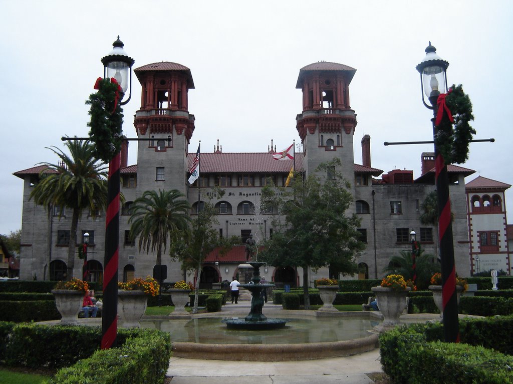
We walked into Stuart today in the pouring rain! This is something we never would have considered in the past (both walking and 'in the rain'). Also ate lunch at a very good Thai resturant "Basil Tree".
Photo: Pam talks with a Blue Heron.


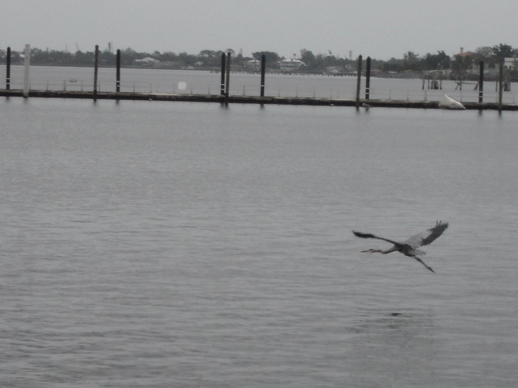
Was it something she said?!

Monday, November 28, 2005

Stuart, FL

Well, we finally got "unstuck" from Velcro Beach!! Left there on Monday and arrived in Stuart that evening. We actually got here at 4pm but ended up waiting an hour for the train drawbridge to open. The bridge closes automatically when a train is 10 minutes away. Three different trains kept it closed for an hour! There is also a vehicle draw bridge right next to the train one but the bridge operator has no idea when the next train is coming.

Stuart, FL has a mooring ball field like Annapolis. There are 80 mooring balls here and most are in use. The city is actually about 6 miles up the St Lucie River off the ICW. It is also on the Okeechobee Waterway route across to the west coast of Florida. Stuart bills itself as the "Sailfish Capital of the World". It is also the headquarters for Kadey Krogen Yachts.
Photo: Sailfish Fountain in the heart of Stuart, FL

Saturday, November 26, 2005

Stuck to "Velcro Beach"

We’re still here... the Velcro rule seems to have attached itself to us. We could sure spend the winter here.

Up very early today, the morning is filled with chores and boat maintenance. We have to run the generator every morning for a couple of hours to recharge the batteries that run the AC appliances and lights. Pam takes advantage of the AC current to vacuum and dry her hair. John is down in the engine room changing the oil and fuel filters. After a morning filled with housekeeping chores it is time to get out and enjoy this perfect sunny day.

We rode our bikes over to the Vero Beach Riverside Park on the Indian River. We rented kayaks and explored the many inlets and lagoons not far from our anchorage. It was hard to believe that we were so close to civilization. The surroundings were so calm and peaceful. We shared this long stretch of water way with the many birds and dolphins and the sounds of the swamp like setting. Still have not seen a manatee. Maybe they really are endangered. We rented the kayaks for four hours. What were we thinking?!! After two hours of paddling we were beat. It is amazing how little effort it takes to glide thru the water but those are muscles that have not been used for awhile.

After a much needed nap we decide to check out the Riverside Bar and CafĂ© down the water way. We launched the dinghy to take a ride over to see what they have to offer. Much to John’s delight the bar has a number of TV’s all with a different college football game on. Have not seen much TV since we left. After an order of nachos for dinner we’re back to the boat. We talk about our trip plan for our next leg down the ICW and we are in bed by 10, which is late for us. It must have been the nap!

Thursday, November 24, 2005

Thanksgiving Day 2005

Happy Thanksgiving, Bloggers! We all have a lot to be thankful for...and we miss being there with all of you. Thanksgiving in Vero Beach is a special occasion for cruisers. For the past few years, a cruiser-organized potluck Thanksgiving dinner has been held. There were at least 150 people attending this year with food of 200! Once we got the ice and snow shoveled off the picnic grounds, everyone had a wonderful time (see, we have empathy!). Not quite the same as Thanksgiving with close friends and relatives...
Photo: relaxing after the snow melted.


Photos: the Thanksgiving we missed

Wednesday, November 23, 2005

Vero Beach, FL


We reached Vero Beach, FL on Monday trying to stay ahead of the cold front due across the eastern part of the country. Departing the ICW, we entered a very sheltered ‘lagoon’ where Vero Beach Municipal Marina is located.

Vero Beach Municipal Marina is in a park like setting offering all the services and amenities that a cruiser could need. Vero Beach is within walking distance from the Marina and with our bikes we can be there in just under 10 minutes.

Photo: Vero Beach Marina (Compass Rose with another Krogen in the middle)

Vero Beach does not allow anchoring. The harbor has a mooring field with about 50 mooring balls each with at least 2 boats and most with 3 boats sharing the balls.

Photo: 3 to a mooring ball

That makes for over 100 boats here for the Annual Thanksgiving Gathering of Cruisers. Everyone will gather this afternoon for a potluck Thanksgiving Day dinner. The dinghy dock should be a site to see with dinghies tied up 3 deep you sometimes have to dinghy hop to get to your dinghy.

Photo: Dingy dock at Vero Beach (are these those manatees we've heard about?)

Vero Beach has become so popular for boaters that it has been nicknamed “Velcro Beach” because once here you just don’t want to leave and many have just made this their winter destination.

When we first arrived at the marina office to register we were given a brochure put out by the city entitled “Vero Beach Where The Tropics Begin, a Jewel in the Crown of the Treasure Coast”. So far we have found it hard to argue with that introduction.

"Shack of the Week"

As we approached the Vero Beach area, we were 'returned' to civilization. Replacing the mangroves were numerous and large houses.

Since this will be the norm the rest of the way, we have decided to institute the "Shack of the Week" photo display. These are our nominations for Week 1:

[Snuck one in from Oxford, MD]

The Blog Continues!!

It’s been almost a week since we updated the blog. Mea culpa, mea culpa….

As you may recall, we last left you at Daytona Beach on our trip south. Two uneventful days on the Indian River with anchorages in Titusville (Cape Canaveral) and Eau Gallie (Melbourne) were mercifully uneventful.

The Indian River is about 3-4 miles wide but only 4-5 feet deep. The channel dredged in the middle has 8-12 feet of water. So, it is mostly an exercise of staying in the channel. Fairly repetitive scenery along the way, mostly mangroves and small islands.

This area was hit hard by two hurricanes in 2004 less than three weeks apart (Frances and Jeanne). What Frances didn’t wreck, Jeanne did. The shoreline is still littered with half sunken boats, pieces of docks and houses with partial roofs.

We still have not seen a Manatee despite the many signs of warning. Of course, we didn’t see any Indians on the Indian River nor bananas on the Banana River!

Saturday, November 19, 2005

Daytona Beach, FL


Left St Augustine early for a 6 1/2 hr run to Daytona Beach. The wind was howling at 15-20 kts from the north giving us a nice 'push' south. Did not go ashore at DB due to the high winds, now up to 30 kts. The waterway is lined with gorgeous Florida homes and condos. Not sure where all the people are coming from...

With the high winds, we decided to put out two anchors. As we tried to raise the first one in the morning to depart Daytona....surprise, surprise!! It wouldn't come up. And, this is the anchor that is not on the 'wildcat' side of the windlass (there are no 'teeth' to engage the links of chain). As John hauled it up by hand the reason for the difficulty became readily apparent once the anchor broke the surface. The anchor was hooked on an old steel pipe (T fitting) approximately 18" in diameter. The pipe was further secured to the anchor with a fishing net and two ropes from other old anchors. Photo: Anchor/pipe/fishing net/anchor lines menagerie.

John got in the dinghy and, using wire cutters, a knife and scissors, was finally able to cut everything free. As Roseanne Roseannadanna says, "it's always something"!

Photo: morning workout hauling in the second anchor (after clearing said pipe)

Friday, November 18, 2005

Map of Florida

For those loyal bloggers not intimately familiar with the geography of Florida, here is a map. The Atlantic Intercoastal Waterway officially begins in Norfolk, VA (Mile zero) and ends in Key West (mile 1242). Florida covers over 1/3 of this. Use this map as a reference for the rest of the trip.

Thursday, November 17, 2005

St Augustine, FL (Day 2)


Let's face it, St Augustine is o-l-d.

Founded in 1565, it has the oldest wooden schoolhouse, the oldest house, the first 'Ripley's Believe It or Not' and a whole host of "oldest" attractions. I think we also saw the "oldest T-shirt shop" and the "oldest homeless person".

Both the St Augustine City Hall (Hotel Alcazar-1888) and Flagler College (Hotel Ponce de Leon-1887) are housed in former hotels constructed by Henry Flagler. Flagler was the partner of John D. Rockefeller in Standard Oil. His name is everywhere in Florida (City of Flagler Beach; Flagler County; Fort Flagler; Flagler Hospital...). The guy truly got around. We will hear more about Henry when we get to the Keys.

Photo: Flagler College
Photo: St Augustine, FL City Hall
Used our folding bikes to get around St Augustine
and also make a run to West Marine.
With a parking problem rivaling Annapolis, this was a great way to get around and avoid that hassle.
Photo: John driving the "SUV"

Wednesday, November 16, 2005

St Augustine, FL


Pulled anchor at 7:00am for the 7 hour trip to St Augustine. The scenary and homes are much different than further north. The homes have a distinct Spanish flavor to them. To make their pools and decks usable, most have humongous screened-in areas attached.

The tidal range here is similiar to GA....8-9 ft. And, it's a full moon now. The photo shows low tide and why one needs to closely follow the markers.


Founded in 1565 as a Spanish military outpost, St Augustine is the oldest continuously occupied European settlement in the country. The Bridge of Lions is the gateway to the city and is in the process of being completely renovated.

We will be spending at least two days in St Augustine. Tomorrow we will venture in at see all the "oldest" attractions.

Tuesday, November 15, 2005

Fernandina Beach, FL


Anchored in the harbor off Fernandina Beach, FL (FL= Florida!)

This is the northern most city in Florida and is located on Amelia Island. The world famous Amelia Island Plantation resort is on the southern tip of the island. Sitting in the harbor, the city didn't look too inviting with its two papermills blowing smoke into the sky. We didn't go in to the city this evening and planned on leaving early in the morning. Photo: one of the two papermills in town.

However, after checking the tides and currents in the morning, we decided to delay our departure till noon when the current wasn't so strong from the south.

Well, that was serendipity! What a nice little town; very historic and shops of all kinds downtown. We ate lunch at the Seafood Market right at the shrimp boat docks. Had fried oysters and shrimp that were probably walking on the Atlantic bottom the night before.

Photo: County Court House, Fernandina Beach

We didn't pull up anchor until 2pm and only went 9 miles more to a anchorage on the South Amelia River.

Photo: Pam and new friend

Monday, November 14, 2005

Florida!!

Crossed the St Mary's River into Florida at 3:10pm today!! We'll be in this state for the next five months....details to follow.

Cumberland Sound/Kings Bay, GA


As we neared the end of our trip through Georgia, two dolphins began playing with the boat and jumping right next to us. It's difficult to get a photo of them since you're not sure when they will surface; but Pam was able to get some good ones. Kings Bay, GA is home to the US Navy's Atlantic Trident submarine fleet. This photo is on the biggest damned building I have ever seen! It is from 5 mi away and, for perspective, those cranes are huge. The Trident subs go into this "hangar" when they are in port.

Jekyll Island, GA


Left St Catherines early and resume the snake-like path through the Georgia lowlands. At times we were down to 2 kts as a 'four-boat-train' felt its way through 4-5 foot waters.
Compass Rose wasn't in the lead so she got to follow a deeper draft sailboat. However, she soon became the leader as the lead dog went momentarily aground.

Transiting Sapelo Sound south of St Catherines we saw this shrimp boat coming in with hundreds of seagulls hitching a ride.

This was our longest run of the trip (52 nm and 9 hrs). Ended up anchoring off Jekyll Island, GA. Went ashore Monday morning and walked around. Jekyll Island was founded in the 1880's by "The Millionaires Club" (aka Rockefeller, Gould, Astors, Vanderbilts, Goodyear, Morgan, Pulitzer, etc). It was a getaway and place to socialize and brainstorm. By WW II, the membership of the Jekyll Island Club controlled 1/6 of the world's wealth. The first transcontinental phone call was made here to California. Also, the idea for the Federal Reserve was hatched here. No telling how many scotches that took!

Photo: Pam on the phone with Carson (how did people do this before cell phones?!)

Photo: Jekyll Island at St Andrews Sound. It's "red right return!".

Little Pictures/Big Pictures

Loyal Bloggers-

Although the photos on the blog are small to save bandwidth, you can 'click' on them to see the full size photo.

Saturday, November 12, 2005

Offshore Cruise


Today we decided to test the theory that the world is flat….instead of the serpentine course through Georgia, we went out into the Atlantic Ocean for a more direct route. We followed the 45’ Florida coaster “Sails” out to sea and used her as the ‘pathfinder’. Seas were 2-3 ft and a little ‘rolly’ but we didn’t have bridges and shoals to worry about. Not much to see out there….not quite in the middle of the ocean but far enough.
Photo: 4.5 mi off the GA coast.

Arrived south of St Catherines Island, GA and anchored in a lovely creek. Went ashore in the dinghy and walked on a pristine beach with many dead trees. As the world's ocean levels increase, the salt water eventually kills the trees. The beach is only visible at low tide…otherwise it is four feet under water.

Friday, November 11, 2005

Hilton Head to Savannah, GA

Attacked the non-working windlass this morning and found a burned out fuse. Of course, you have to be a contortionist to get at it!

Rode our bikes to West Marine and a grocery store. Three speeds (on the bike) is definitely tougher than ten...

Hilton Head is a small barrier island about 10 mi by 5 miles and has 25 golf courses. We only rode through a small section but it was gorgeous. If you haven't been here yet, I would put it on your "to go" list. Photo: The lighthouse at Harbour Town, site of the PGA Heritage Classic).

Hilton Head to Savannah took us through more winding rivers and cuts. Welcome to Georgia! Crossed the Savannah River about seven miles south of the city but decided not to go up river. As we were approaching a narrow cut, we heard a tug boat broadcast that he was pulling a number of barges. Actually, he had over 1500 feet of barges, dredging pipes and US Army boats (see photos). We went to idle and watched as he made the turn into the river. There were three other tugs stationed along the barges to act as pusher/pullers.

What an incredible site and also a remarkable piece of seamanship. Photo: We hide behind the red marker as the tug starts turning his barges.

Photo: 1500 ft of barges!